
Our research: Human-Elephant Conflict
Human Elephant Conflict

Human Elephant Conflict (HEC) is defined as “any human elephant interaction which results in negative effects on human social, economic or cultural life, AND/OR on elephant conservation and the environment”. HEC is a huge problem in all elephant range countries, and is a serious threat to the Sumatran elephant. HEC incidences usually involve elephants eating and/or trampling crops, damaging farmlands and a number of cases have caused human deaths. This has led to retaliatory killing of elephants using poison, electrocution and man-made traps. Various techniques have been trialled to combat HEC in Asia including; community crop guarding, noise, fire, alarms, repellents, biological and non-biological fences, buffer crops, translocation and capture, all with differing levels of success. To address the problems of HEC it is vital to obtain information on where and when this is happening, the severity of HEC and local attitudes towards elephants. By gathering this information, we can work together with the community and governments to allow appropriate mitigation to be implemented, thus protecting both the people and this critically endangered species.

As HEC is one of the most serious threats to the Sumatran elephant, this has to be an important element of our work. In almost every area around the Ulu Masen and Leuser Ecosystems where human settlements and farms are located close to forest boundaries there are reports of conflict. In Aceh alone the media reported 36 elephant deaths due to poisoning, electrocution and man-made traps between 2012-2015, 3 more reported in 2017, one in 2019 and 5 elephant deaths in 2020. Therefore firstly, we need to undertake a comprehensive study on HEC around these ecosystems, to provide the necessary in-depth understanding required to approach the problems in an effective manner.
To do this, we are beginning to gather qualitative and quantitative data through undertaking questionnaires to assess the current level of HEC, the context in which conflicts occur, and the underlying causes of these conflicts. We then hope to develop a monitoring system that continuously provides information to allow the forest department to act and investigate these incidences. Though this initial work, we aim to develop site specific strategies to mitigate HEC, whilst also increasing the acceptance and importance of elephants by the local people through various workshops. In the long term, we hope to be able to implement mitigation techniques and train local people to become wildlife rangers, to monitor conflict and actively support the conflict mitigation.
We have begun to collect data from areas in both north Sumatra and Aceh to compile a map of conflict hotspots around areas of forests where elephants are present. This will allow us to understand where the worst conflict areas are and where assistance is needed.

Our research: Leuser Ecosystem - Aras Napal, Besitang

How Aras Napal reduced HEC through changing crops.
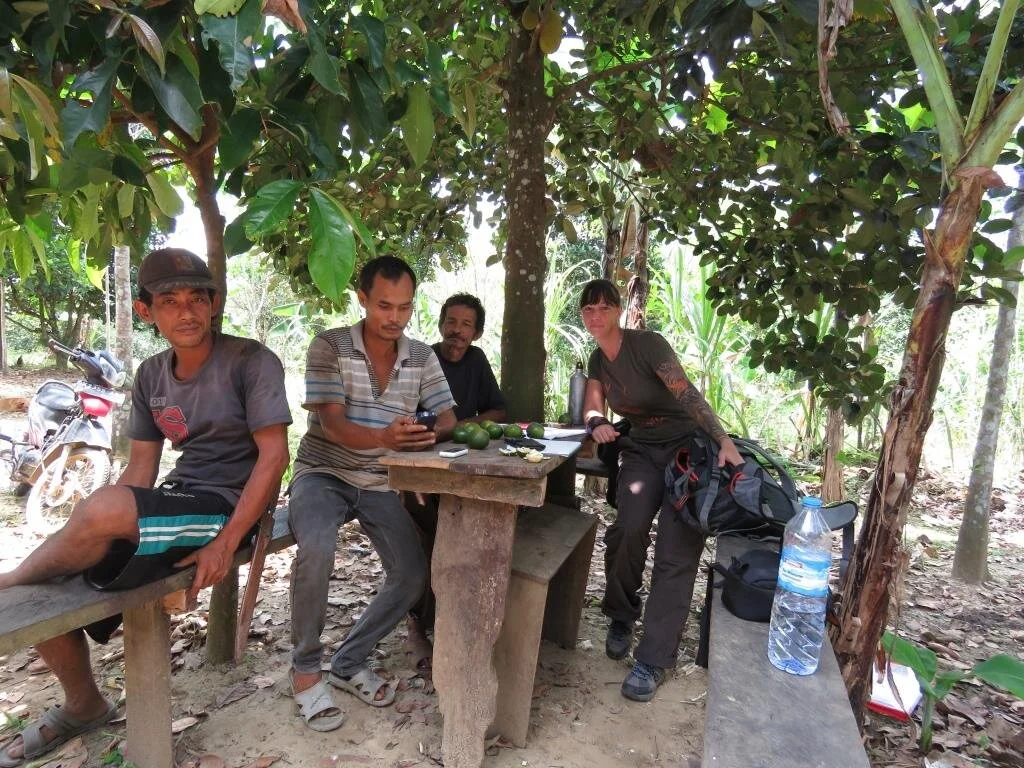
Within the Langkat district of north Sumatra, adjacent to the Sikundur forest area lies two villages, Aras Napal kiri and Aras Napal kanan. These villages and their farms border the rich lowland forests on the eastern edge of the Gunung Leuser National Park. In 2016, I conducted around 30 questionnaires with farmers from both of these villages. Many farmers at that time grew corn, and reported significant problems with elephants coming into their farmland and destroying their crops. They used traditional methods of scaring the elephants away including fire and loud noises. Some used fireworks but the elephants always came back.
In 2019, I conducted more detailed questionnaires within the villages, to hopefully discover more information regarding the elephant conflicts here. However, I discovered the elephant conflict on these farms had significantly reduced, and many people reported very few conflict incidences with elephants. What was the reason for this? The answer was simple… the farmers had changed their crop type. The farmers within the villages had gotten together and realised that the elephants targeted the farms that grew corn and avoided the farms that grew oranges. Within 3 years, all farmers in the area changed their main crop to oranges. The 2019 survey found that farmers reported fewer sightings of elephants, and those that had seen elephants in their farms just reported the elephants to pass by, and not damage the orange trees. This is a great example of how people and wildlife can coexist with minimal conflict by simply understanding the behaviour of elephants within an area and the willingness of the people to adapt.
The Aras Napal community group
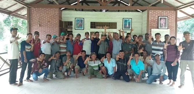

More than 30 residents from the villages in Aras Napal have come together and formed the group ‘ Wisata Aras Napal 242’. The group was initially created as the residents grew concerned when they saw more and more illegal activities being conducted inside of the national park. They realised that if nothing was done, they would lose this important and valuable habitat. Following meetings with the Indonesian Nature Conservation Agency (BKSDA) and the National Park Authorities (TNGL) they have been granted permission to open the area for both local and international tourism. This amazing local community have come together to protect the forest by providing income through tourism to many of the village’s residents, and allowing both local and international people to visit and learn the importance of the Sumatran forest and its endemic wildlife. Visit our ‘get involved’ page to see how you can help.
Our research: Leuser Ecosystem - Sekoci, Langkat District, north Sumatra

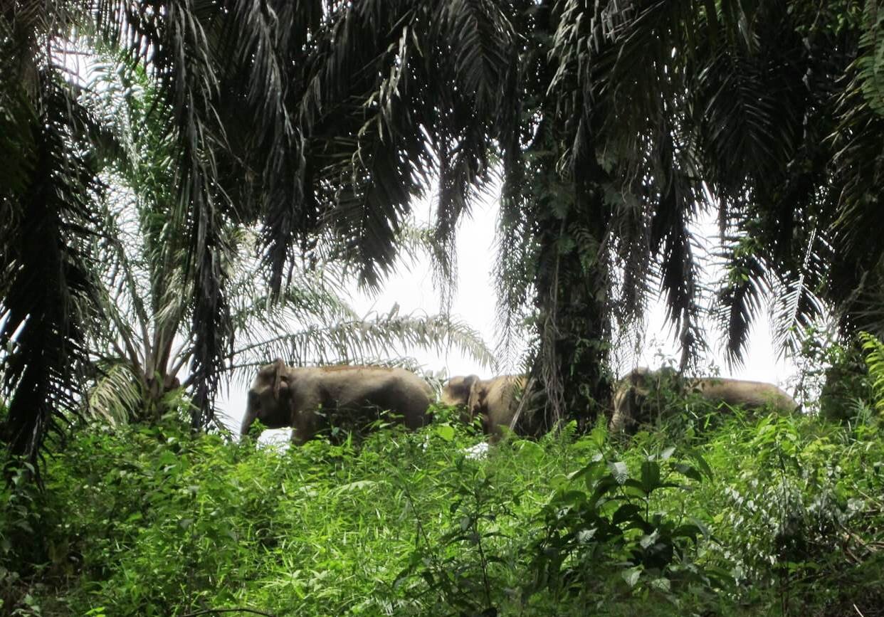
The Sekoci area is located ~2km southeast of Aras Napal in the Langkat district, north Sumatra, and is actually located inside of the Gunung Leuser National Park boundaries. Within the last 5-6 years, this 350 hectare area was cleared of primary rainforest, and much of the area now looks like a vast savannah (see picture). It is unsure who commissioned this clearance, but in the absence of forest, many people moved into the area and made settlements, small villages and farms, mainly around the edges, next to the forest. Although illegal, the national park authorities now faced the difficult challenge of how to deal with this situation without severely affecting peoples livelihoods. They made the decision to allow the people to stay here, but with the following conditions: 1. Each farmer/family could only use 1 hectare of land, and it was forbidden to clear anymore forest. 2. Each 1 hectare area was not owned, and therefore could not be sold on to a third party. 3. Palm oil was not to be planted in this area. 4. Large local trees, including durian (local fruit) and mango must be planted alongside other crops, to allow some recovery at least to this barren landscape. These large trees were hoped to provide some habitat for wildlife, and allow species movement within the area.
Interviews were conducted with the farmers of Sekoci in January 2019, to identify any conflict with wildlife (including elephants), identify any wildlife within the area, and to acquire peoples perception/views towards wildlife. From the preliminary data analysis, very few elephants are now seen within the area, and the last major sightings of elephants by farmers were from at least 3 years ago. The only conflict people reported was from monkeys and wild pigs. The results lead us to two presumptions: 1. The cleared area became unappealing to the elephant population, and they moved to another area or deeper within the forest, or the lack of suitable food resources from large scale clearance has caused this population to become virtually extinct. By undertaking the population survey later in the year, locations of elephant dung will shed light on elephant movement and maybe more information on what has happened to the population here.
Although elephants are not a major concern or threat to people here, it is still of importance to increase awareness of the importance of elephants and other wildlife, and the importance in forest conservation. Villages here were generally quite positive towards wildlife and benefits of forest habitats including being a source of clean air, clean water and healthy living.

Our research: Leuser Ecosystem - Tangkahan area, Langkat Regency, north Sumatra.
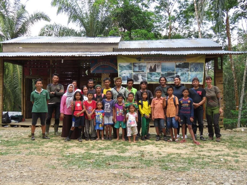
Tangkahan is located within the Langkat district of north Sumatra, bordering the east side of the Gunung Leuser National Park. In 2001, a local organisation called ‘Lembaga Pariwisata Tangkahan’ (LPT) was formed to develop eco-tourism as a new livelihood, preventing illegal activities such as logging within the area. This has been highly successful, and the area is now known as ‘the hidden paradise’, attracting many tourists each year. Additionally, in Makmur, Sei Lepan, the village of Pancasila, approximately 20km north of Tangkahan, have formed a group called ‘Leuser Lepan Baktiwisata’. This group are working together with the National Park authorities (TNGL) to monitor and protect the elephant population here, and to promote tourism to provide the community alternative incomes and benefits from living in close proximity to elephants. However, with the recent COVID-19 pandemic, relying on tourism can be difficult, and thus promotes the need of finding more reliable solutions to conflict, that are sustainable over the long term.
All villages bordering the forest in the Langkat district up to Besitang have conflict issues with wild elephants. These villages mostly grow rubber and palm oil, and elephant’s frequency visit. Not only do the elephants eat and destroy trees, but the presence of elephants within the farmland mean people cannot harvest the rubber, as it is too dangerous to enter the area when elephants are present.

HEC surveys in Tangkahan area have commenced , beginning in the village of Sumber Waras. This village is small, with only 9 families residing here and elephants are frequency seen most weeks. It is planned to work together with this community in building a watch tower, allowing the local people to more effectively monitor when elephants are within the area, thus preventing conflict incidences.
Please see our ‘get involved’ section on how you can help this village.
Our research: Ulu Masen Ecosystem - Aceh Jaya and Pidie districts, Aceh.


Covering an area of 3,813km2, the Aceh Jaya Regency is located on the west of Aceh and has a population estimated in 2019 of 92,900 people. The regency is split into 6 districts; Teunom (36 villages), Panga (19 villages), Krueng Sabee (17 villages), Setia Bakti (13 villages), Sampoiniet (38 villages) and Jaya (48 villages). Most people within the area are farmers, and the main crops grown are rice, rambutan, durian, oranges, water melon, rubber, palm and coconut oil. The Ulu Masen protected forest is located to the east, and is an important habitat for the Sumatran elephant. This protected forest is under threat due to land clearance for farmland and mining activities. This habitat destruction results in elephants coming into increased contact with human settlements, with a high level of conflict reported. Thus, this area is a hotspot for HEC, with a number of elephants being found dead from poisoning, electrocution and man made traps.
To enable us to target areas of conflict in Aceh, conflict incidences reported within the last 10 years (from 2010 to 2020) were complied from media reports and internet searches. Within the Aceh region, Aceh Jaya, located on the western edge of the Ulu Masen and Pidie, located on the eastern side were identified as hotspots for HEC with the highest number of elephant deaths reported from these areas. Therefore, we began undertaking surveys here in March 2020.
HEC Surveys in Aceh Jaya
In March 2020, interviews were undertaken with 35 farmers from 14 villages in 5 districts in the Aceh Jaya region. Interviews consisted of a semi-structured questionnaires to obtain data on elephant and wildlife conflict within each village, level of conflict, frequency of conflict incidences and the responses of people to this conflict. We were warmly welcomed into each village, and people were very willing to share their conflict experiences with us. Data has yet to be analysed, but this preliminary survey has allowed us to begin to form relationships and gain trust with the villagers, and we plan to work with these communities setting up workshops and conflict monitoring, to begin to aid with conflict.
Pidie and HEC surveys.
Pidie is a regency of Aceh, located in the Ulu Masen ecosystem bordered by Pidie Jaya Regency in the north, Aceh Besar Regency in the west, Bireuen Regency in the north and Aceh Jaya Regency in the southeast. Pidie Regency covers an area of 3, 087km2, and contains a population of 443,700 people. Pidie is also known for its rice production, producing 20% of Aceh’s total rice output. The regency is divided into 22 districts.
Interviews were conducted in 12 villages in 5 districts in March 2020.
Once these results are analysed we will update this page…..stay tuned!